The gathering crowd on the opposite bank of the river collectively grinned at me as I reluctantly began to pull off my boots and shorts, down to my underwear. There was no other option at this point. No way was I backtracking over 10km to do the winter diversion of the Margaret River Crossing when my destination was a mere stone-throw across the surging water in front of me. Having already walked 33km in driving sideways rain, hail and wind that day, forward and through was my preferred option. I judged the river to be only about 10m wide at this point… it looked only knee deep with a clear sandy bottom on my side. But the other side was dark tea-tree brown, a channel of faster moving water rushing through to the breaking surf. It was shallower down near the tide but frighteningly choppy and tumultuous, large thumping waves smashing heaves of white water and foam into the spreading river mouth.
I loosened my bag straps to ensure a quick unhitching of the dead weight if I was to take a tumble during the crossing. Eyeing the spectators to ascertain if any of them would likely be of help in the event of a mishap, or just merely an audience to my impending dunking, I steeled my aching body to make the move…
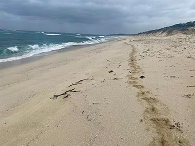
The Margaret River at Prevally Beach, looking innocuous at first…
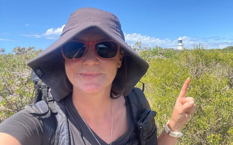
Three days earlier I had started the hike in a blaze of sunshine and blue skies, under the watchful presence of the Cape Naturaliste lighthouse. First a plane (Adelaide to Perth), then a train (Perth to Bunbury), a bus (Bunbury to Dunsborough) and eventually a taxi (Dunsborough to Cape Naturaliste), and I was finally operating under the steam of my own legs, trundling happily along the start of the trail. The Cape-to-Cape Track runs for approximately 126km along the very south western corner of Western Australia, along a most spectacular stretch of coastline, right at the confluence of the Southern and Indian Oceans. Punctuated at each end by the Cape Naturaliste and Cape Leeuwin Lighthouses, the trail meanders past sleepy coastal towns, the hottest of surfing and fishing spots and through some of the most gloriously unique National Parks. It’s certainly not hampered by its proximity to the West’s premier wine destination, the Margaret River region. October was set to be a brilliant time to walk the trail: spring weather, not yet too windy or hot and the possibility of whale spotting in the rolling seas on my horizon. As if on cue, within 200m of setting off, I catch a glimpse of the shining black breach of a Southern Right Whale. I am on the track!
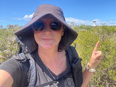
Sunshine at the start, at Cape Leeuwin Lighthouse near the township of Dunsborough, Northern Terminus of the trail
I’m planning on taking 5 and half days to walk the complete track, staying at the designated campsites along the way, with my tent, sleeping gear and food in my pack on my back. And of course, a good book. If that seems like a big ask, compare that to the 19 year old woman I shared my taxi with – she explains her plan of smashing it out in a mere three night sprint, to my incredulous response! Go get it girl! Off she zooms into the distance, leaving me in her wake taking photos and soaking all the detail in. This first section into camp is my ‘half day’ of 11km, and what a thoroughly lovely couple of hours it is too. The track is predominately ‘access for all’ for the most part, wide and bituminised with a gentle cadence taking in all best view points of the sea and scrub. I am immediately enamoured by the flowers that abound on the side of the trail, a smooth green sea of scrub highlighted with purples, yellows and whites. Magic! I happily roll into the Mt Duckworth campsite, nestled among the melaleuca, golden evening sun filtering down to my tent site and contentedly start preparations for my dinner. Day 1 is complete.
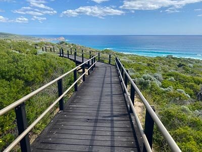
‘Access for all’ Track, at the beginning of the trail
4:30am is still last night in my books, but here in the west there is no day light savings, plus factor in the time difference from Adelaide, and I am awake and ready to go startingly early in the day for me. For anyone really! An easy 5km with a short beach walk brings me to the first trail town of Yallingup. Oh, I love the particular sound of WA specific words, many having adopted words of the traditional owners Noongar language, in this case the suffix ‘-up’ meaning ‘place’. This sweet coastal holiday village is a salt water lovers delight, with some of the hottest waves breaking over the reef right behind the foreshore’s natural lagoon, already full of locals doing their morning laps in the protected crystal water. I find a coffee van selling its addictive goods and a bloody beauty of a banana bread, and settle in to watch the Saturday morning surf comp start. I while a good hour away chatting away to a friendly local, Bernie, who offers me his number in case I need trail support anywhere along the line. Winner! When I eventually drag my breakfasted body onwards, it is firstly a bit of soft sand walking past Smiths Beach then up on cliffs for a large spell on 4WD tracks through to the Moses Rocks campsite, completing 23km for the day. Sheltered again by Melaleuca and surrounded by bright purple flowered daisy shrubs, I am visited by a very confident Bandicoot or Quenda, who I later discover is a regular and well known ‘local’ by the name of ‘Steve’. No Steve, no freeze-dried bolognaise for you mate.
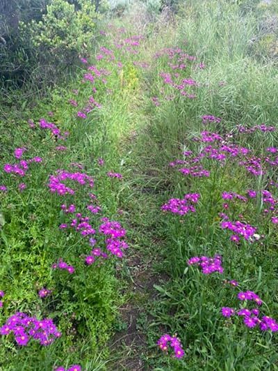
The trail into Moses Rock Campsite, stunning flowers abound!
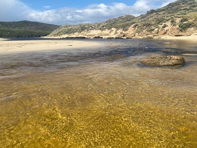
Day 3 begins with an 11km stroll along more 4WD track into the trendy surfing village of Gracetown, meaning another real coffee and croissant for breakfast, cunningly planned so I had less food to carry on my back. I nab a phone charge whilst sheltering in the café from the sudden onslaught of hail and wind, people-watching the uber chill retirees and cool surfer kids as they debate getting wet. Sharing my table in the packed-out café, is Greg – a surfer from Bunbury who is camping at the caravan park, also seeking refuge from the downpour. When it eventually eases, he accompanies me on the first hour south out of town, on a mission to check out the conditions of a walk-in only surf spot. It can sometimes be nerve wracking to agree to the companionship of strangers when you’re a solo female hiker, but the track is fairly well populated with day walkers, even considering the inclement weather, so I consent to the company. We spend a few minutes before leaving town taking in the heartbreaking memorial to 11 locals, both students and teachers, lost tragically to the collapse of a nearby limestone cliff, as they sheltered from the rain whilst watching a school surf comp. I can only imagine how the pain of that day reverberates through such a small community. Leaving Greg to contemplate the surf, a long day stretches out in front of me. The trail winds up and over headlands, down through the old Ellensbrook Homestead, past waterfalls and creeks, grottos and rock formations, all under the constant offering of rain, wind and the occasional hail storm. As I over take section hikers, I question them of their intel on the Margaret River crossing conditions. The track crosses the river mouth in the coastal village of Prevally, 9km downstream from the busy tourist town of Margaret River itself. All walkers tell me the mouth was closed that morning, or at least only a shoe-off crossing, when they left their vehicles at their end point. The winter trail diversion decision has to be made 5km out from the actual crossing, making the 10km backtrack an unfavourable option for a weary walker like myself who will have already trudged 33km by the time I hit the river. In the weather I have been hiking, I am fantasising about a cabin at the caravan park instead of my damp tent, a hot shower and warm bed…
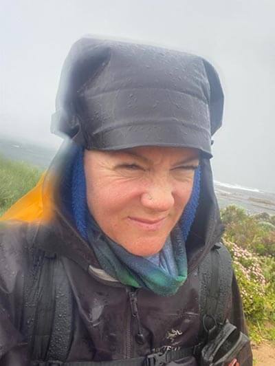
Weather conditions were not always favourable to me…
On arrival at the river mouth I discover the late afternoon tide has broken the sand bank and I face a more complicated crossing that expected. Wading in up to my knee I tell myself I have this. Think of the hot shower on the other side! At least the water isn’t THAT cold. Bloop! Softer sand than anticipated sinks me down to the waist line, and I steady myself against the current, ignoring the jeers of encouragement from the onlookers. I’ve made it! I drag myself up the sandy bank, smiling and exhausted. Unfortunately, there is no room at the inn. At any inn in fact, as I call around to all the accommodation options Prevally has to offer. Nooooo! Unbelievable considering it’s a Tuesday night outside of school holidays! Resigning myself to another night in my tent, I drag my bedraggled butt up to the Caravan Park anyway, and on presenting a very sorry-for-myself look to the lady behind the counter, she offers me a cabin that has yet to be cleaned, promising it has only been slept in one night by another solo woman. I throw my money at her before she can reconsider, grab that key and hobble down to my little room of paradise, cranking the heater and spreading damp gear all over the cabin in a sigh of pleasure. Oh boy, you better believe that hot shower, pub meal and glass of wine that night was worth every penny! Bliss!
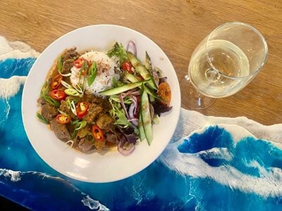
Dinner at the Sea Garden Café in Prevelly, after a long and wet day and river crossing
Fortified by the luxuries, I start the fourth day with a positive step, immediately up a hill. It’s a bit of a tough trail out of Prevally, but the beginnings of the tall trees keeps me motivated, and a plethora of native orchids and new plants to marvel at slow me down as I fill my phone with pics. Leeuwin-Naturalise National Park reminds me in many ways of Flinders Chase National Park at the western end of Kangaroo Island, and indeed the Kangaroo Island Wilderness Trail and the Cape to Cape area have many similarities, sharing a history of geological beginnings. Sandy trails, limestone caves, Southern Ocean swell and that special something in the air. Right down to both trails having recently experienced some pretty severe impact from bushfires, they are almost identical in their recovery phases, as the graphically black and white burnt arms of the larger trees and shrubs reach up out of the bright green regrowth – I could be on either trail and not be able to tell which was which in some sections. Both are stunningly good. I’m enjoying my audiobook as I wander through the tall Karri forests, wind my way through green maze-like channels, climbing in and out of gullies, crossing creeks on volunteer-built bridges and enjoying the views at well considered bench seat locations. In some places the trail is only as wide as my legs, in others it’s a full 4WD track wide, but its generally always excellent underfoot. The rain is getting to me but at least my bag is getting lighter as I progress, and I set up camp under the canopy of the tall trees after another mammoth day, listening to the surf crash in the distance and the birds call as the evening sun sets on my last night on the trail.
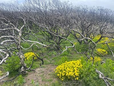
The similarities with Kangaroo Island Wilderness Trail continue down to include the fire recovery process
Day 5 is going to be a tough one, I am tired and the weather hasn’t improved – and unfortunately there are a few long stretches of beach walking to contend with. I have come to agree with the plan of instead walking this trail South to North (the opposite of what I have done), as it ticks of the harder beach walking while legs and spirits are still fresh, keeps the wind at your back, and starts the day in Prevally with a more successful River Crossing option, instead of worrying all day long that you will be stranded on the wrong side of the river from that glass of wine and hot shower. Walking into Hamelin Bay was a hard stretch but is rewarded by enjoying the antics of the local sting rays, frolicking in the shallow blue waters, lined with interesting and pretty cliffs. Finally, the Cape Leeuwin Light house comes into view and I gratefully purchase a hot coffee at the souvenir shop, surely looking as windblown as I feel to the clean and tidy tourists coming from the nearby town of Augusta to explore the homes of the lighthouse keeper families. Another similarity to the Cape De Couedic end point of Day 2 of the KIWT. French names and everything, thanks to Nicolas Boudin, the French explorer, cartographer and naturalist who renamed a lot this southern coast line in the early 1800’s, crossing paths with Matthew Flinders in South Australia at Encounter Bay. I hail a lift to my hotel in Augusta and sink gratefully into warmth of town comforts, a day earlier than I had planned. Aching body, damp and sandy gear, and a hunger that can’t be quickly satiated, I know I will be back to tackle this stunning track again, it was just too good.
A long stretch of beach walking right at the end! Unless you start south and head north and get it out of the way first, recommended!
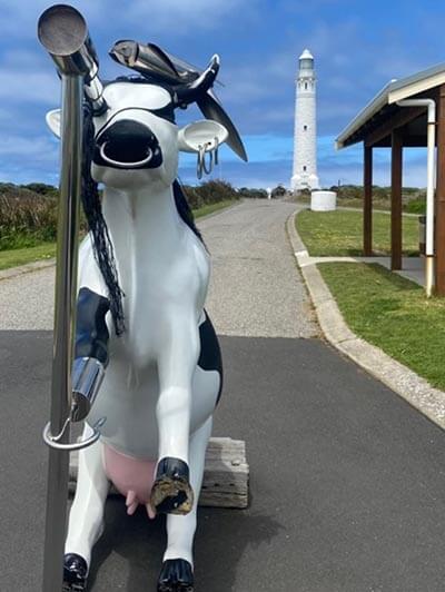
Cape Leeuwin Lighthouse and… Pirate Cow?
Additional Reading
Big Heart Adventures is a commercial tour operator (CTO) and lead walking adventures along the Cape to Cape and throughout Australia and overseas. We offer fully guided walking tours and self guided walking adventures.