What is the Kangaroo Island Wilderness Trail like 4-years after the devastating 2020 bushfires?
Big Heart Adventures’ walk leader, Kylie, went on an adventure to find out!
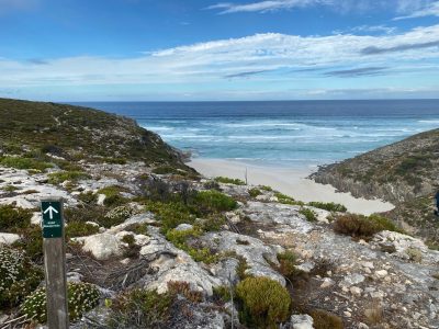
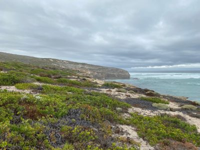
After four years of remarkable rehabilitation and rebuilding, December 2023 saw the original KIWT reopen. In January 2020, the devastating fires that affected many parts of Australia also ripped through Flinders Chase National Park, destroying almost all of the original trail and burning approximately 41% of the Island. Later that year, an alternative route opened to offer the Kangaroo Island Wilderness Trail – Fire Recovery Experience so that walking enthusiasts could still enjoy this beautiful environment, albeit a modified version of the original trail made up of reroutes and individual walks, and without campsites. It was not possible to do the Fire Recovery Experience independently; instead, walkers needed to book through a tour operator. Lisa and Ian were the first to walk the new route. Check out a Vlog of this adventure from December 2020 – it’s so incredible to see the regrowth and difference in the landscape in Kylie’s photos.
Also known as Karta Pintingga, Kangaroo Island is a remote and rugged wilderness. It is spectacular in its coastal beauty and wildlife and sits just off the coast of Cape Jervis, southwest of Adelaide. Starting at Rocky River and finishing at Kelly Hill caves, the KIWT is a five-day, 73km trek through Flinders Chase National Park on the far west coast of the Island.
Kangaroo Island Wilderness Trail (KIWT)
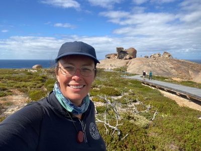
In March 2024, I, along with three other leaders from Big Heart Adventures, did a recce of KIWT. None of us had walked it since the 2020 fires, and only a few of us had walked it before. I’ve been wanting to revisit this trail, as I absolutely loved my experience in 2019 and have been curious to see how it has recovered since the fires.
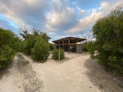
The through hiking trail only reopened 4 months earlier in December, and its availability isn’t well advertised, so not many have hiked it yet. The trail is largely the same – we were issued the same map that I had pre-fires. The campsites have been reinstated with some improvements included in the rebuild. The main upgrade has been animal proof cupboards installed under the cooking benches in the shelters so we can store food in there without the worry of animals trying to get to it in our tents!
DAY 1 – Rocky River to Snake Lagoon 12km. Spur 4km
Campsite – Cup Gum
Luckily, we found out the day before that our ferry had been cancelled, but we were able to reschedule and get on the 6.30 am departure instead. This enabled us to still fit in our day’s walking, and after arrival, we drove straight to Flinders Chase National Park for an induction with a staff member at the visitor centre. The visitor centre is a temporary structure until they build their spandangled new one, which, from what we gathered, is not going to be built any time soon.
The distance markers are set up for the new start point, so it felt like I was back on the Camino, with distance markers and watches wildly out of sync!
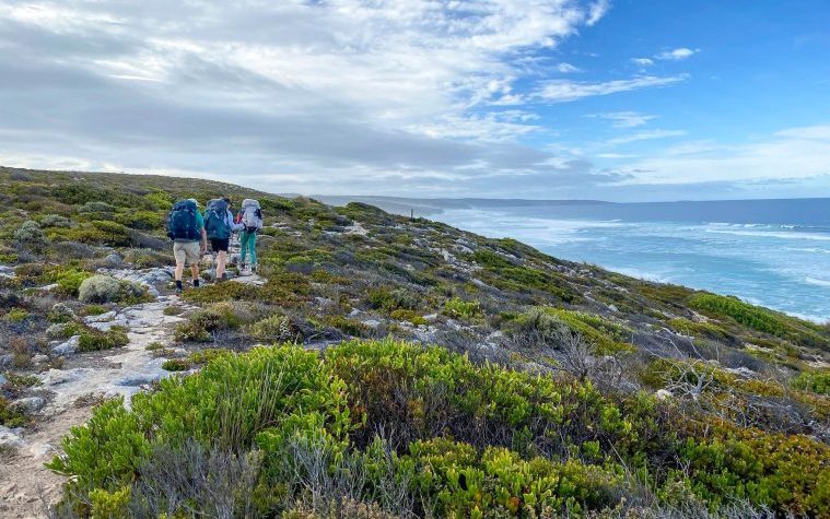
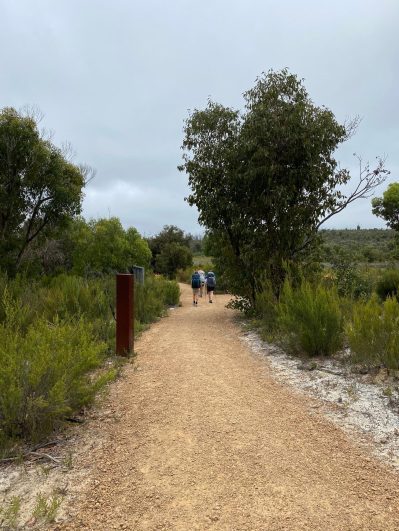
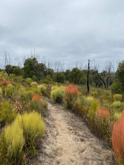
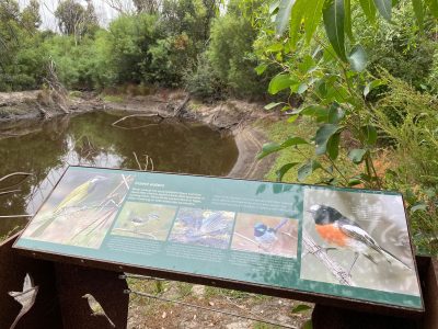
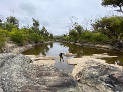
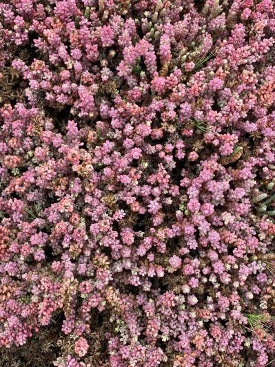
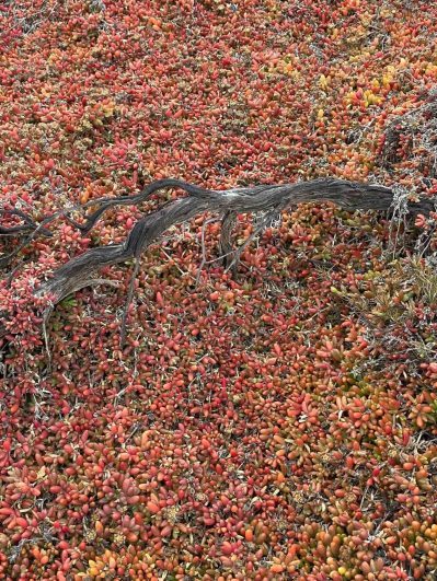
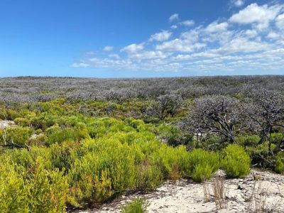
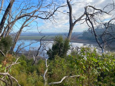
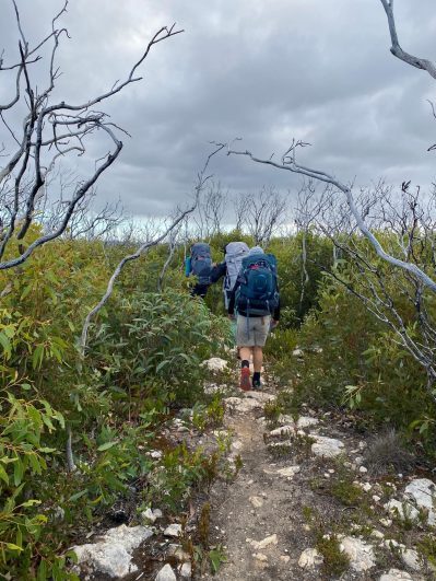
The walk to Platypus Holes was pleasant, and it was great to see all the new interpretative signage along the way. Many of our native plants and trees thrive on fire, and the regrowth looks lush and healthy.
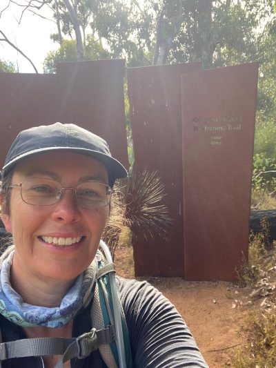
I love the attention to detail in the signage posts with the cutouts corresponding to whatever the sign is about: birds, fungi, etc.
After the platypus holes (no platypus were sighted), we continued on, and the manicured path gave way to a less maintained trail. So much so that there were times when I thought a machete would come in handy to clear the track! Luckily, all week, there was a couple who left camp before us and cleared away all the spiderwebs 🙂
The trail is rocky in places, and when it’s not rocky, it’s sandy. Echidnas and other creatures digging holes have caused some major earthworks, so no matter what part of the trail you are on, you have to watch where you are walking. Trust me, after having had two falls on this trip, I know!
After we set up camp, we headed to the river mouth. Swimming is not recommended here as the tides come in quickly. There are also a lot of rips, so it’s safer to stay out of the water at almost all the beaches along the trail. Hanson Bay Beach, en route to Tea Tree Campsite (Day 4), is considered the only safe beach for a swim.
Day 2 – Snake Lagoon to Cape du Couedic. 14km
Campsite – Hakea
This is one of the trickier days on the trail. It’s open and exposed with little to no shelter, so if you need to do a bush wee, don’t expect to have much privacy!
We had much cooler weather and some rain today, which, compared to the 35+ temps I had when doing the trail in 2019, I’d take cool weather and rain any day!!
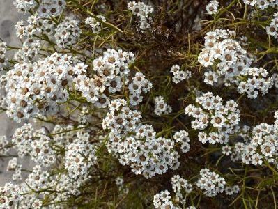
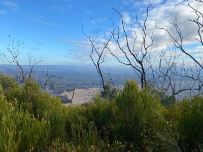
There were moments when we would say it’s now time to choose our own adventure as the trail wasn’t very apparent. There were regular orange posts or way markers, so we knew where we were heading; it was just a matter of connecting the dots. These moments gave us more time to admire the landscape, and the surrounding wildflowers and flora regrowth were staggering, not to mention the stunning colours.
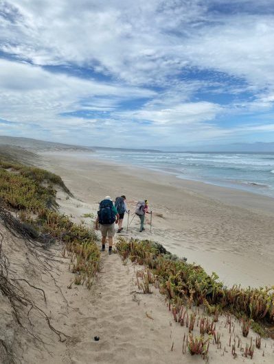
Providing the timing is right and you are there at low tide, there is a beach walk section at Maupertuis Bay. If conditions do not allow a passage via the bay, an alternative route through the sand dunes is available. The sand on the beach was soft, so it was a bit of a slog, but I think the sand dunes would have been much harder, as you would be trying to find the trail as well.
The beach walk section wasn’t very long; we took about 25 minutes to cover it, and that’s with heavy packs. There’s a great spot at the end of the beach where we sat for a morning tea break. From there it’s a bit of a climb up the sand dune back onto the rocky path.
When we got to our campsite, there were fewer platforms than the site before. Each site had fewer platforms, and the tent pads were compacted rock, which bent the pegs, and the small rocks damaged the tent flooring. It might be advisable to pack extra strong pegs (anodised aluminium is good) and bring along some sort of lightweight, ground cover to lay beneath your tent.
Day 3 – Cape du Couedic to Sanderson Bay 15km inc Remarkable Rocks
Campsite – Banksia
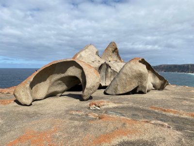
We took the spur trail to Remarkable Rocks and arrived just as a busload of tourists showed up. We left our packs at one of the viewing points, and when we were at the rocks, we started to wonder about the 2 ravens hanging about in the tree near our packs. I know from Operation Flinders that they can be quite cunning and get into backpacks. Fortunately, our packs were left untouched!
This section has more rocky paths and my ankles had become quite unhappy by this point!
There were rock pools below with seals lounging about and the seal pups were having a great time. It was fun to watch them frolic about and we could have easily stayed long, but we had walking to do.
We didn’t do Admirals Arch as those in our small party had either seen it before or would be seeing it on an upcoming Big Heart trip, so we saved ourselves a few kilometres.
Day 4 – Sanderson Bay to Grassdale 13.5km
Campsite – Tea Tree
I am sailing!
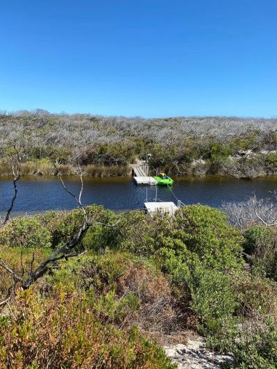
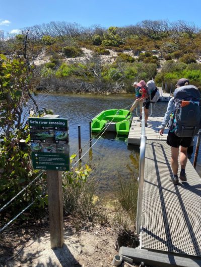
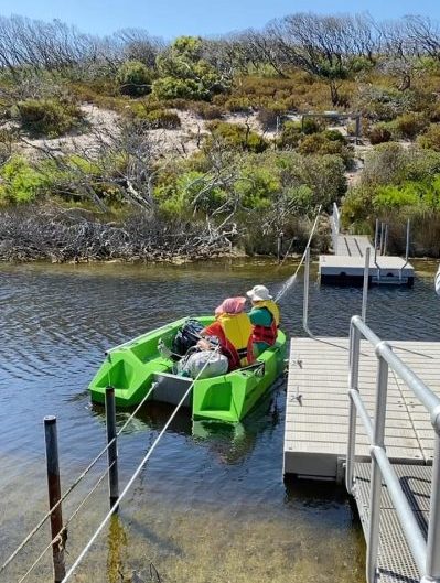
It’s river crossing day, and this section is the highlight of the whole trail! The original infrastructure here was destroyed in the fires, and the newly constructed setup is a significant upgrade!! There are now platforms to get in and out of the boat more easily. Before, there was only a tiny ramp and you virtually had to get into the water to climb into the boat.
We headed right to Hanson Bay for a swim, and let’s just say it was invigorating! Some of our group immersed themselves fully and enjoyed the ‘cold water therapy’. I didn’t get fully wet but went in up to my knees and it felt so good. The only downfall was the 2km walk from there to the camp on dirt trails, so the clean feeling didn’t last long.
It was our last night on the trail, and it was lovely to arrive at camp and relax for a while.
Day 5 – Grassdale to Kelly Hill Caves 7.5km
Our last day on this amazing trail.
We started off by passing Wilderness and Grassdale lagoons where there was a lot of birdlife on the water. We stopped and watched the parrots before continuing on.
One thing I noticed in this section was the size of the yaccas. I didn’t take many photos of them but they were huge! Apparently after the fires, they were the first to regrow. As soon as one week after the fires there was already regrowth sprouting. They are vital for regeneration as they help feed the insects and smaller creatures until other plants regrow.
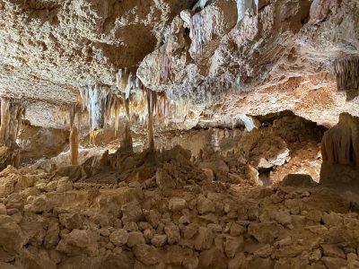
We arrived at the end – yay! —and got there in time to take the earlier Kelly Hill Caves tour. They have new facilities here, which are so much better than the asbestos building that was there previously.
One of the other improvements is the trail leading up to the caves is more gentle and stops at a few lookouts now instead of a straight uphill slog. They also have improved the cave experience by adding a lighting and sound experience (created by Illuminate Adelaide, I believe) to take you through the evolution of the caves. It was a great experience.
Once we finished exploring the caves, we made our way back to Penneshaw via Emu Ridge Eucalyptus Oil Distillery to get a top-up of Eucalyptus oil, some lotions and potions, and I bought a bag of emu feathers 🙂
We had a bit of time before the ferry, so we did the Sculpture Trail while we waited.
All in all, it was a great experience, and I am so heartened to see how well it has regenerated.
I’ll be back!!!
Additional Reading
Big Heart Adventures is a commercial tour operator (CTO). Registered to lead walking adventures along the KIWT on Kangaroo Island and throughout Australia and overseas. We offer fully guided walking tours and self guided walking adventures.
You can see our Kangaroo Island walks here
Read more about ‘Big Heart Adventures’ and our wellness walks
Get information on our women’s walking group ‘Wise Women Walking’
We look forward to sharing a Big Heart Adventures South Australian Walking Experience with you!

