Author: Lisa Murphy
Walk the Yorke is a long distance walking trail around 500km in length between Port Wakefield and Moonta Bay on stunning Narungga Country/Yorke Peninsula in South Australia. Endurance comes to mind with longish days between towns or campsites and the challenge lies sometimes in the terrain being too flat, exposed and too hard for the feet rather than hills and inclines and creek crossings that many bushwalks offer.
So after a pretty stressful 18 months since COVID changed our world, we decided to take a break. To take a nice long walk. A therapeutic healing from within and with nature kind of walk. Lots of fresh air each day, camping, cooking simple one pot meals to sustain ourselves and nothing more to think about except walk, eat, sleep repeat.
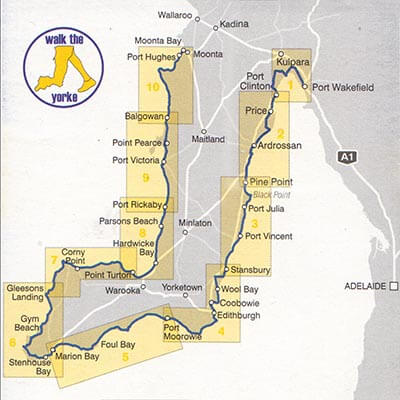
We convinced the in-laws to be our support crew and dog sitter for 4 weeks and we sneakily marketed this to them as relaxing weekends away with us with covert tasks such as bringing our much-needed food and fuel supplies, helping us with catch up sections and anything else we had forgotten every 5-7 days or so. What a great way to explore stunning Narungga Country and Yorke Peninsula we thought. They thought so too.
Welcome to Chapter 2 of our Walk the Yorke End to End Adventure. If you missed Chapter 1 Port Wakefield to Coobowie click here.
Day 8 SULTANAS AND WIND
Coobowie to Goldsmith Beach 20km (7 hours)
Boom. We were awoken by a thunderstorm at around 5am. The walls of our bedroom actually shook with that one.
We had just spent 2 nights in a gorgeous beachfront dog friendly holiday house called Smooth Sailing at Coobowie. Our rest day was spent catching up on work, laundry and hanging out with our support crew – enjoying more food of course and having a few laughs. Lots of goodbye cuddles with Gulliver and gratitude to the support crew once more for delivering our next weeks food and supplies and we were off, fully loaded and ready to rumble.
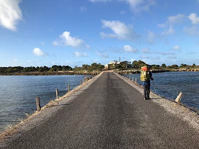
We walked through Coobowie and over a causeway that crossed a waterway to a coastal trail that we then followed all the way to Edithburgh. It was a very windy and chilly morning and we took a short break and sheltered at the Tidal Pools which we imagined returning to in warmer conditions.
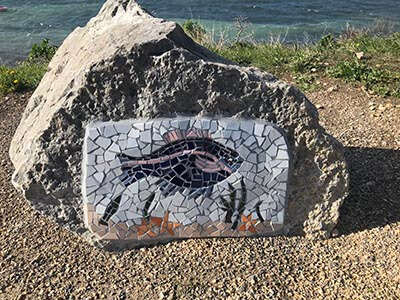
Once out of town we found ourselves on the pretty Mosaic Trail and we have to say the interpretive signs were really cool and geared to educate families and kids about marine life.
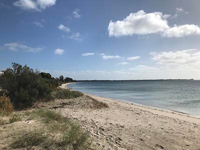
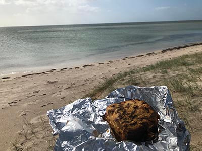
We stopped for a morning tea break out of the wind at a calm little beach shelter and funnily enough we had sultana cake at Sultana Point. Coincidental as it was left over from our stay at Coobowie but fitting nonetheless.
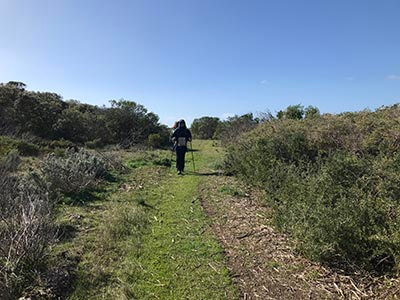
It kinda felt like we were about to leave civilisation for a week as there were no more towns now til Marion Bay. The holiday homes started to space out and suddenly we were on the edge of Sultana Point looking at windfarms. The scenery became more and more bushy and the trail was gorgeous (nice and soft after all the road walking), even the fungi seemed happier out here.
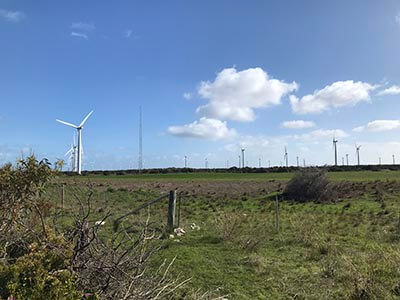
Birds crossed the trail and were chatting away as we observed almost all the wind turbines in action across the field ahead. Then it was onto beach for about 25 mins to our lunch spot at Wattle Point. The shadows of the wind turbines flicked across us in slow rhythm and the noise was quite loud as we battled the wind to get the water boiled for soup and a shower of rain, feeling excluded from the challenge of our quest, gusted in just for the fun of it. We considered briefly camping here as the sites were sheltered and bushy but the wind farm was just too close and we decided to move on.
Goldsmith Beach was just a short walk away, so we loaded up with water returned to the beach and we pitched our tent in the best spot we could find despite the wind and hoped for the best.
We had heard about the lockdown called from 6pm that night and this left us a bit unsure of what to do next. We pondered on our options for the following day. Our support crew had left for Adelaide so we were unsure if they would be allowed to return to get us and the car had departed Coobowie full so it would not have fitted us and our huge backpacks even if they turned around to come find us, so we slept on it thinking we might be able to continue with the supplies we had.
Day 9 CLIFFS
Goldsmith Beach to Port Moorowie 22km (7 hours)
This was probably our best day of walking on the trail so far. We woke after a hugely restful night for one of us and the other spent the wee hours fighting a mouse. Cranky beginnings despite another gorgeous sunrise. Coffee in the tent was much needed, but with no water at this campsite, we had to conserve.
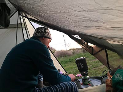
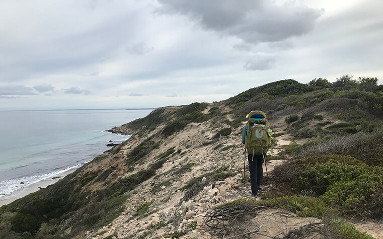
The day started cloudy and still after a bit of drizzle overnight. We returned to the beach briefly where the ocean was glassy with gentle waves. Then it was on to a dirt road where it became a gorgeous cliff top scenic walk for the rest of the morning. Lots of seabirds, mostly cormorants, sooty oyster catchers and plovers to be seen.
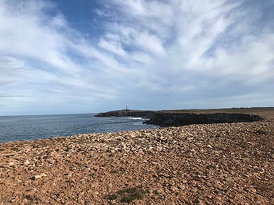
Approaching Troubridge Point the lighthouse looked like a baby giraffe in the distance. We could not stop looking at the delicious swell and look for whales – it seemed like the perfect day to spot one. A gentle northerly was keeping the waves clean and offshore. We saw a seal frolicking off the rocks and about four dolphins plus a couple of fishing boats. Even though it was cliff top road walking the scenery made up for it.
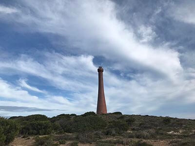
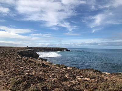
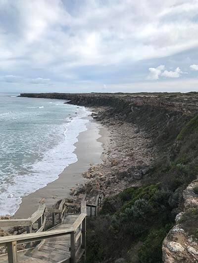
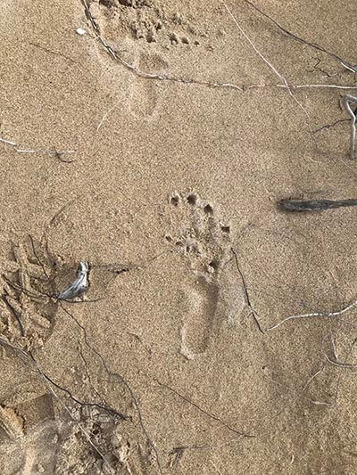
After about 10km we hit an intersection where we followed a high dune trail that skirted beaches and bays only accessible by boat – stunning. Even the foot prints in the sand had us wildly imagining what strange animals lived in these parts. Markers were a bit few and far between but just when we thought we might have missed a turn off, a shelter appeared on the coast below.
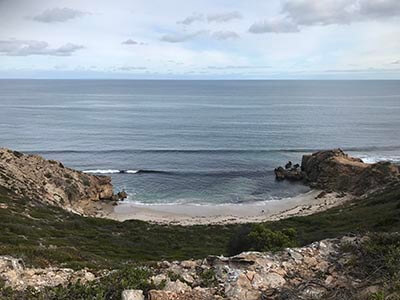
Our lunch stop would be at Kemp Bay Shelter and it was a beauty. No wind and the sun shone, giving us an opportunity to dry a few damp items and have lunch without battling the elements. So nice. Seriously thought about camping here too. The beach was divine and more dolphins joined us for a cupasoup and tuna wrap. We sat and watched the waves roll in. Ah the serenity.
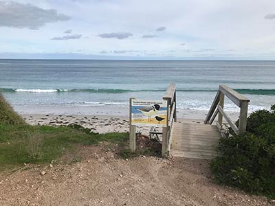
Reluctantly we had to move on knowing we still had about 8-9km to go. Initially we had a bit of dune walking and then it was onto a bush trail between scrub and farmland that was also another patch of wombat country.
A giant farm machine passed us spraying weed killer and while we almost dived into a tree and covered ourselves up as much as possible the kind farmer waved and turned off the sprayer as he passed us. The chemical smell lingered though and we stayed masked with our Buffs until we reached the outskirts of Port Moorowie.
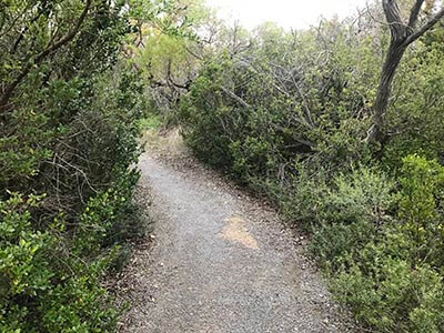
What a little surprise Port Moorowie was.
A long stretch of holiday houses mostly with coastal scrub, cliffy and short sandy beaches and enticing swell. Despite a bit of road walking and resting at strategically placed benches along the way we reached the public loos and shelter just as sunset arrived. With blisters on feet, no accommodation to book into or shops, we decided for safety reasons to make camp just out of town.
We had also phone coverage here and a long chat with our support crew delivered us news that while initially we had the green light to continue our walk being so remote and out of COVID hotspots, SA Health had changed their directive and we were told we should be picked up as soon as possible. With the weather about to deliver another huge amount of rain and thunderstorms and no accommodation past Port Moorowie for a couple of days walk, our decision to be picked up was made for us.
We made a rescue call to friends Linda and Paul at Wallaroo and we were to be picked up the next morning – our support crew would meet us in Wallaroo to avoid a 7 hour return drive.
We hit a giant PAUSE button here.
Lockdown lifted after 7 days and we returned to Narungga Country and our adventure a week later.
As this was a driving day from Adelaide we did a couple of short sections that allowed us to get back on the trail and slightly more organised for this next leg (pardon the pun).
Day 10 TIDES
Black Point to Port Julia 8km (90 mins)
Port Moorowie to Mozzie Flat 3km (45 mins)
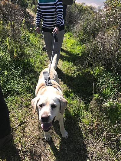
We caught up on that elusive tidal section missed thanks to storms back on Day 5 in stunning sunny conditions and even Gulliver our gorgeous labbie walked a small section between Black Point and Port Julia. He was pretty stoked about that too. It was clearly a section that you didn’t want to be caught out during high tide with cliffs and nowhere to go, we were grateful we had snuck it in on the low tide.
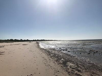
Our support crew picked us up at Port Julia and we detoured to Port Vincent kiosk for an awesome lunch. Fast service and delicious meals, we ensured we got our hot chip fix and finished off with hot cinnamon donuts. Because we could. It was back to one pot meals from tonight.
We farewelled our amazing support crew at Port Mooroowie by mid afternoon and fully loaded with water and food once more, we set off for Mozzie Flat. We didn’t know for sure if there would be a tank at this campsite so we carried 8.5 litres between us. If it was a dry camp we would make it to the next water source by mid morning the next day.
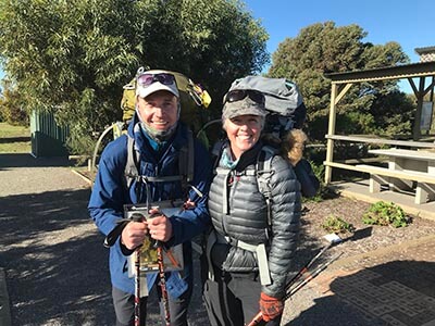
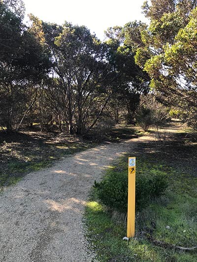
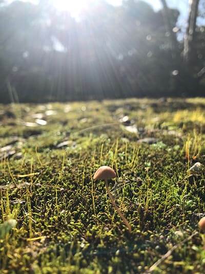
A little 3km walk was ahead and can we just say, we fell in love a little bit more with Port Moorowie. The trail out of town was gorgeous with beautiful trees filtering light, mossy soil and fungi. Plus the surf looked surfable. A fence walk led us to a bush reserve and our campsite that included a rainwater tank after all.
With the campsite to ourselves we changed into our thermals and wandered around stripey with reckless abandon and skipped dinner retiring to bed at the ungodly hour of 5.30pm. The wind dropped as the sun set. It felt so good to be back!
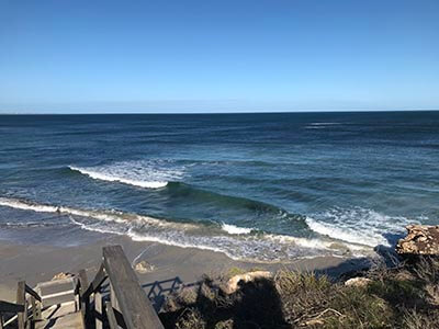
Listening to the surf crashing on the other side of the dune we looked forward to sunny weather tomorrow and a big section of walking. There were no mozzies at Mozzie Flat.
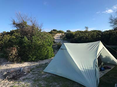
Day 11 SEA CREATURES
Mozzie Flat to Foul Bay 33.5km (10.5 hours)
We woke well before sunrise wanting to get an early start for what we knew would be a HUGE day. It was really windy overnight and a bit more rain fell. The tent was dry though – for once the wind was handy.
The beach was right behind our campsite and all 17km of it needed to be walked. It would also be 15km before we reached our next water tank.
It was high tide as we started but with the recent storms, the sand had been eroded by big tides and surges so it was a comfy walk on relatively firm sand. It was weirdly humid and warm.
It was all about the sea creatures today though and in the first 3 hours we counted 38 shark eggs (Port Jackson sharks), starfish, the biggest shell I had ever seen plus dolphins, birds, sea urchins, crabs, seaweed and coral pieces that looked like musical instruments.
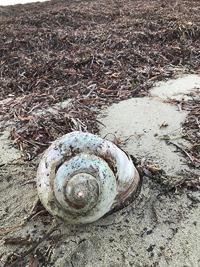
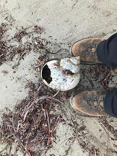
The winds were light and the clouds high and quilty. The ocean was glassy and with rolling hypnotic swell. We both went inside our heads for long passages of time stopping to talk about the myriad of life and death on the shoreline.
We reached our lunch spot at Sturt Bay shelter very early and had the usual soups and wraps. After leaving here the beach just opened into white sand and turquoise waters. It felt tropical even.
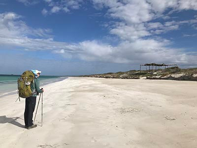
As we approached Port Davenport Conservation Park we realised the “ship” we thought we could see out to sea from just after leaving Mozzie Flat was in fact a bunch of tall trees! So we left the beach just before reaching the “ship” and we meandered in all kinds of disorientating directions through and around the Conservation Park. Scott Creek had a bit of water but the landscapes were salt lakes and tea tree swamp. It was sheltered from the breeze and it felt really warm again.
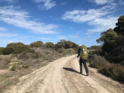
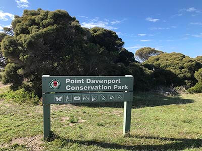
The markers for this section were a little confusing and one in particular telling us to walk on a vegetated road reserve was leaving us perplexed. There were 2 roads both appeared to be public roads but claiming to be private separated by very thick impassable scrub. We changed roads a few times where there were gaps in the trees but it was not clear. We struggled along the road(s) for 5km before we hit South Coast Road feeling pretty spent.
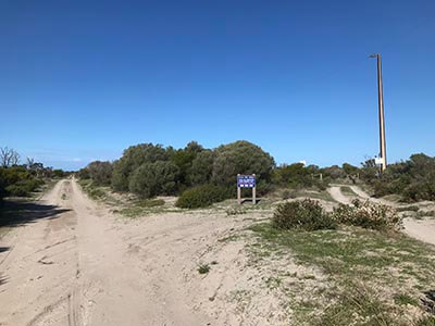
After nearly 30km our bods were feeling it. Our feet and hips were relieved to reach the campsite after a bit of winding around scrubby trails once off the gravel. It was a dig deep kind of ending.
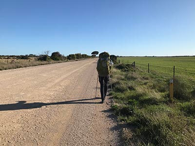
We reached the Foul Bay campsite with just enough light to examine blisters and heat rashes and thankfully the campsite was empty. Within an hour of arriving, we had cleaned ourselves up, popped up the tent and scoffed a lazy dinner of mac and cheese.
Day 12 FOUL
Foul Bay to Hillocks Drive 12km (4 hours)
Pain relief was needed to find sleep after such a huge day yesterday and getting started today was an effort. The fatigue hangover was real and plastering toes, protecting heat rashes and getting dressed seemed overwhelming. Coffee was needed again in the tent before any action could be taken. The rain had started around 3.30am and we expected a few mm at best. The forecast was looking a lot kinder than it had a few days ago though. But could we trust this change of forecast?
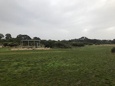
We set off on the most mentally challenging scrubby section that we got suitably lost in. The trail simply disappeared and we lost markers. We back tracked and returned to the beach where we figured if we just stayed parallel to the water we would reach Foul Bay but markers started to appear again convincing us to go into the bush and took us off course again and again. Eventually we decided to make our own trail and we found some hidden markers where the scrub had simply overgrown what was once a trail. This reminded us that dune systems are moving constantly and trail marking through these landscapes is always tricky.
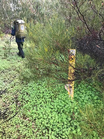
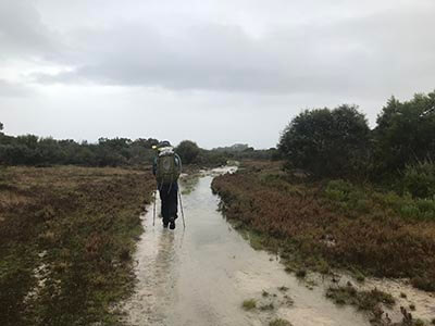
While we struggled to get an updated forecast due to poor phone coverage, the rain just did not let up. It was steady and unrelenting. We walked a long section of South Coast Road with the rain driving into our faces. KI Lookout had no visibility at all across the waters as we turned into Hillocks Drive.
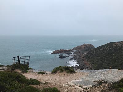
At this point, one of us (me) was feeling 100% miserable and wet weather gear, despite promoting goretex technology, had started to fail. There was a Walk the Yorke shelter that would provide some reprieve and a loo stop, so we separated briefly as Ian wanted to follow the trail. As I walked nearly an hour along the road to the shelter and waited, I realised I could be here for a while. As I came out of the toilet, I could see a figure walking on the same road that I had in the far distance. Phew. We would be able to make a hot drink and reassess our options. The altered forecast had not predicted this much rain. With phone coverage, the BOM revealed 8mm had fallen but the forecast was 0-3mm. Insert swear words here.
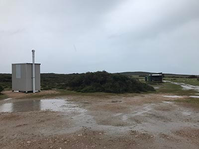
Our plan had been to camp at Hillocks Drive but our boots were soaked in and out and while the deep contents of our bag were safe in dry sacks, our clothing had started to find soakage around seams and zips. Even stopping for lunch and a hot drink had left fingers and hands numb. Our tent was still wet from our stay in Foul Bay too.
After another discussion about options and not wanting to end up on the news, a decision was made to pull the pin and see if Hillocks Drive had any accommodation available. After a couple of quick calls, we were booked into a homestead and walking as fast as we could through ankle deep puddles at times to get to the office to check in.
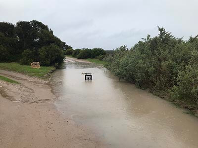
Thankfully we were able to use the space to dry out our gear, pop heaters on, take a hot shower and work through the frustration of what had transpired. It just shows we could not trust the forecasts and we would try and remember this next time we planned for stuff – all of it can be unexpected. Nearly 18mm fell in that 24 hour period.
We checked in on the world and then checked out again, choosing to retreat to the far more utopic world of being off grid.
Day 13 SAND
Hillocks Drive to Marion Bay 16km (5.5 hours)
Despite the comfort and safety of being indoors, sleep was not easy to find. Heavy rain fell hard overnight and another thunderstorm came through rattling the windows with crashes of thunder. Despite all this, the sun was shining through white clouds in the morning and as we packed up and tidied up, the vibe was much higher than the day before.
The final act of departure was putting on our boots. As dry as your socks may be, believe me there is nothing more challenging on a sensory level as putting a freshly socked foot into a damp boot. The feeling of seepage is revolting. Even reliving that moment is uncomfortable.
We negotiated more puddles and hit the dunes trying to pick up the trail seeing markers but not following exactly the right direction. We ended up unsuccessfully using the stairs near one of the ocean pods to enter the beach where we would walk in soft sand, over a rocky outcrop, racing the waves to pass on the sand as the tide receded to one final steep push straight uphill. It was a slog with the heavy backpack and we realised this was the toughest climb we had experienced so far as there were so few hills like this. The rewards though were the views back along the beach and the high trail to Hillocks Point.
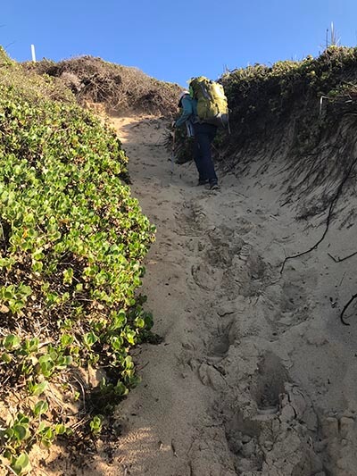
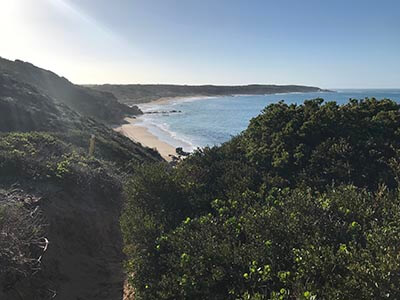
Having day walked this section a couple of times before we recognised the unmarked turn off onto rocks that would allow us an awesome rocky scramble down to the beach. The alternative was jumping down cliffs according to the map. So we opted for the survivable option. We loved this bit!
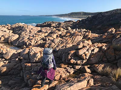
Along Salmon Beach, the waves crashed loudly. The sand was soft and we slogged it slowly until the beach ended with surf smashing into high cliffs. The way out was up. And it was steep.
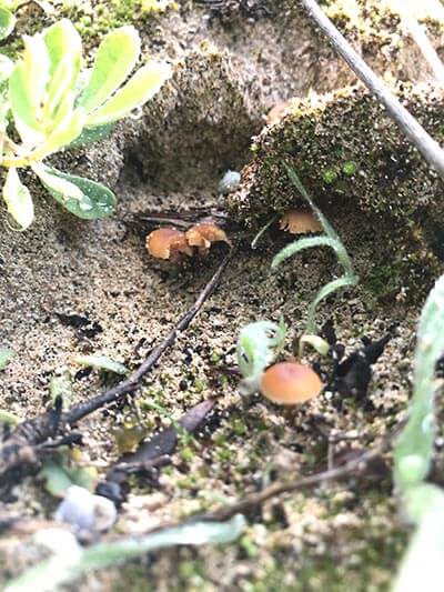
I turned back at one point to take some footage of the awesome looking waves. Just as I headed off again I noticed fungi – in the sand. I don’t think I had ever seen the two loves of my life, fungi and the beach come together in one place. It was a moment.
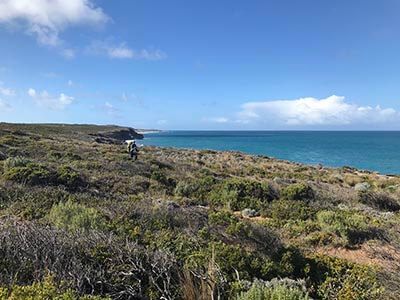
The sky was clear and almost still. We were now on the cliff top heading out of Hillocks Drive toward Meehan Hill Lookout and it was just divine. The views out to sea (hello Kangaroo Island) and of the cliffs ahead and behind us were just stunning. The waters were deep blue, aqua and turquoise depending on where you looked. Plus the sounds of the waves crashing into the cliffs was thunderous. Exhilarating even.
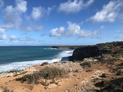
And now was our chance to get even closer to the loud surf. From Meehans Lookout we dropped down onto the beach and within 15 metres from us the waves deafened us with violent contact with the sand. Waves were fighting eachother creating huge splash.
The first few kilometres felt cleansing. It was as though all the negative energy from yesterday was being beaten out of us by these waves. We walked single file, mostly so I could use the footprints to reduce the effort. Very soft sand and a lot of it.
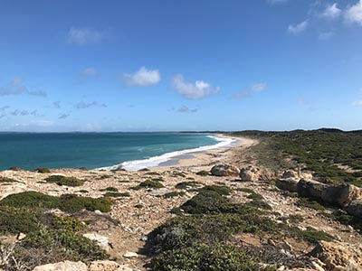
We knew we had about 9km of this sand walking before we would reach Marion Bay and it was getting close to lunchtime. We contemplated stopping for a beach lunch. The air was still but the sand walls were quite tall and we couldn’t really get off the beach properly plus the tide had started to come in. We also had phone coverage again and after the drama of the day before, we wanted to do a weather check to see if we would need to stay in Marion Bay accommodation or walk on to a campsite.
The forecast was suggesting a very wet 24 hour period and once we left Marion Bay we would be forced to camp until our support crew picked us up in 2 days time.
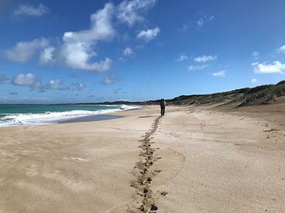
That was the decider – we checked in to Marion Bay Seaside Apartments and also wondered if we would make the 2pm cut off for a lunch order at the Marion Bay Tavern. Dolphins passed us as we tried to find pace but our bodies were warm and the rashes and blisters were yelling. The illusion of distance had fooled us as the beach weaved around more little curves towards the jetty. Despite missing the lunch order by 10 mins, the Marion Bay Tavern serve pizzas all afternoon so we sat outside in the beer garden in what felt like a spring day and snorted a Tandoori Chicken pizza. The General Store supplied us with the rest of the afternoons indulgences and we succumbed to the comforts of apartment living for the next couple of nights.
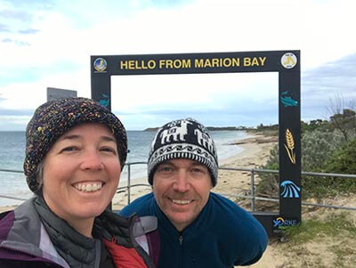
Day 14 RHINOS
Marion Bay to Stenhouse Bay 8km (2.5 hours)
Our rest day was very restful. The predicted rain hit just as we got out of bed at lunchtime, headed back across the road for a meal at the Tavern and then we rolled back to the apartment for more rest and movie watching. It definitely felt like the right thing to do. The rain continued on and off in howling winds overnight. At times it was heavy.
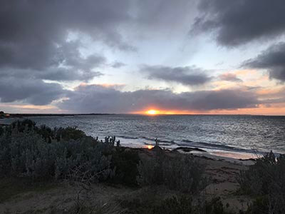
By sunrise though it had stopped and while it looked cloudy it appeared only a few showers remained on the radar so we headed off early knowing our pick up was booked for around 11.30am.
As we walked toward the Marion Bay jetty the sun was rising like giant egg yolk between clouds. We turned and headed through the caravan park towards Willyama Beach. The Willyama is a ship that ran aground here in April 1907 and was carrying coal among other supplies, some of which was salvaged. Coal can still be found washing up on this beach and the mast of the Willyama is still visible poking out of the sea most of the time. There are actually 85 shipwrecks on the Yorke Peninsula – incredible to think. Even Marion Bay was named after a ship that wrecked in 1862 (a steamer called the Marion).
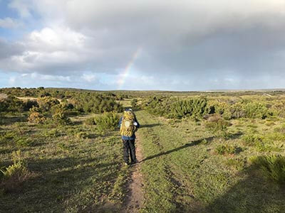
After a bit of road walking we found ourselves entering Dhilba Guuranda-Innes National Park. After so much rain it was so green, swampy and even lakey in parts. We woke a few roos as we followed a trail that passed dense areas of coastal scrub. We saw Jollys Beach, Rhino Head (the point that literally looks like a rhino from a distance) and reached Little Emu Beach right opposite Stenhouse Bay campground after a couple of hours since leaving Marion Bay. We did a bit more poking around to note the location of rainwater tanks and taking in Stenhouse Bay from the shelter.
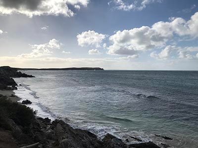
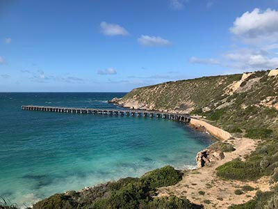
While we had walked into a head wind we had been lucky to only have a few showers on the trail so far. We knew our ride would be arriving shortly, so we walked out of the Park to our meet spot. Someone with four legs was pretty happy to see us and for now our adventure would take another pause as we returned to Adelaide for work commitments.
So did we feel recharged?
Did nature provide the much needed therapy we hoped to experience while walking?
YES. The days walking along the beaches and especially into Marion Bay filled our cells with oceanic awesomeness.
Was it the best section?
So far yes! We really loved the remote walking. We didn’t see another human for 2 whole days. In fact we saw more dolphins than people over a 5 day period. Being prepared knowing there was no shops or accommodation was key to moving through this section successfully despite the interruptions.
Being just over half way, we still had so much to look forward to.
To be continued…
Additional Reading
Big Heart Adventures is a commercial tour operator (CTO). Registered to lead walking adventures along the Walk The Yorke and throughout Australia and overseas. We offer fully guided walking tours and self guided walking adventures.
You can see our Yorke Peninsula walks here
Read more about ‘Big Heart Adventures’ and our wellness walks
Get information on our women’s walking group ‘Wise Women Walking’
We look forward to sharing a Big Heart Adventures South Australian Walking Experience with you!

