Author: Lisa Murphy
Walk the Yorke is a long distance walking trail around 500km in length between Port Wakefield and Moonta Bay on stunning Narungga Country/Yorke Peninsula in South Australia. Endurance comes to mind with longish days between towns or campsites and the challenge lies sometimes in the terrain being too flat, exposed and too hard for the feet rather than hills and inclines and creek crossings that many bushwalks offer.
So after a pretty stressful 18 months since COVID changed our world, we decided to take a break. To take a nice long walk. A therapeutic healing from within and with nature kind of walk. Lots of fresh air each day, camping, cooking simple one pot meals to sustain ourselves and nothing more to think about except walk, eat, sleep repeat.
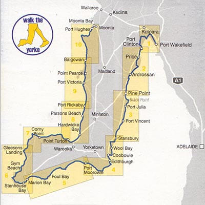
We convinced the in-laws to be our support crew and dog sitter for 4 weeks and we sneakily marketed this to them as relaxing weekends away with us with covert tasks such as bringing our much-needed food and fuel supplies, helping us with catch up sections and anything else we had forgotten every 5-7 days or so. What a great way to explore stunning Narungga Country and Yorke Peninsula we thought. They thought so too.
This is Chapter One…….
Day 1 CLAY AND MANGROVES
Port Wakefield to Port Arthur 15km (4 hours)
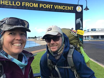
So we started our adventure in Port Wakefield – 100km or so from Adelaide. Other than a fuel stop Port Wakefield is better known for bakeries, hot chips and gravy and a loo stop. If you leave the main road though this little town has a nice waterfront area where the sea ends at the Gulf of St Vincent. The landscapes are very mangrovey and swampy up this end making this a diverse spot to start.
With a rush (as always) we set off late from home knowing full well we were not fully prepared but would make do with what we had including untested brand new equipment. We had to be walking by 1pm in order to make it to camp before sunset. After a quick bakery lunch and send off at the start sign, we were off!
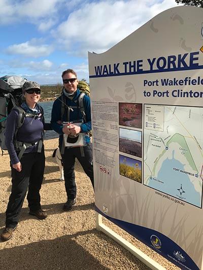
The packs weighed a ton with 7 days of food and full capacity of water as our campsite would be a dry one. The afternoon was a still one. And it was muddy from recent rain. We realised we were walking parallel to an old railway that used to link all the way to Wallaroo. While the railway was no longer the embankment remained and actually made an easier walk than the slippery clay.
The clay though was so interesting – it had dried in places and peeled almost creating clay waves. The samphire and pig face lined the trail in varying colours and as we trudged out of town, we skirted the edges of the Clinton Conservation Park. The tide was in and the estuaries we needed to cross in places were high enough that we had to walk to a shallow point to cross.
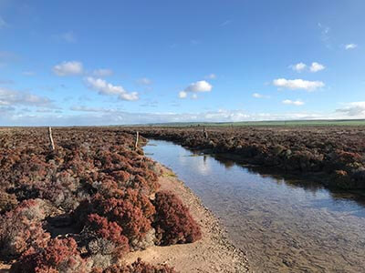
The 15km that we had to cover would take us about 3-4 hours given the terrain was flat and with full packs we took the opportunity to rest on the benches (some with company) that had been placed and allow our bodies to adjust to the new conditions.
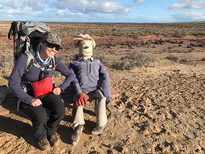
We hit the highway about 10km in and the odd motorist would give us a toot of encouragement as we made our way to Port Arthur, a site with not much more than a roadside rest area, fishing spot and farm country on the other side of the highway.
The sun was setting as we arrived and dropped our bags to look for a spot to camp. The highway was close and loud with trucks passing at 100km an hour so we found camp behind some bushes to try and block out some of the noise. Then it was a case of trying out the new tent (Drop + Dan Durston XP Mid Tent) that we had only put up once in the backyard and how to cook on a jetboil that hadn’t been out of the box yet. This is also when Ian realised he had not packed his air mattress. Good thing we were camped on sand.
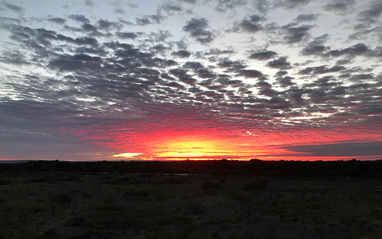
Then the mozzies arrived with a spectacular sunset.
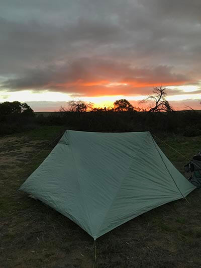
The symphony of blood sucking buzz almost drowned out the burner as our roast chicken, vegie and gravy mix rehydrated. With much haste we ate before the food was ready and escaped into the tent as our fans (the mozzies) hovered between the tent and the fly. It was barely 6.30pm but for some bizarre reason (might have had something to do with the 5am get up) we were both out like lights only waking with the trucks passing in the stillness of the night.
Day 2 ROLLING ROADS
Port Arthur to Port Clinton 18.8km (5 hours)
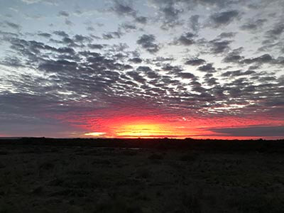
We woke early as the traffic started to increase around 5.30am – we didn’t mind as the sunrise today was jaw dropping.
We had planned on doing a big day and hopefully make it to Price but the forecast was already suggesting some serious weather was coming through later that day and 25km with still fairly heavy packs was daunting. We had not trained at all – in fact I had to cut the tags off my new Osprey Ariel Pro (sourced via a thorough fitting with staff at the Scout Outdoor Centre) that I had never used so I was still finding my groove with the straps and adjustments. At just under 1.7kg when empty this was the lightest pack I had ever owned.
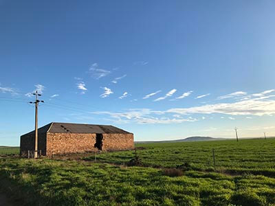
We decided to skip a cooked breakfast and hot drinks and walk the 4km up to the shelter on the hill where there would be rainwater and views of the Gulf. Not bad. The walk was on road and basically went uphill gradually past green pastures. We stopped at the Woolshed also known as a jail for Aboriginal people who were shot here cowardly through holes in the building. There is always more than one version of history no matter where you travel.
We walked on in sombre silence, sad to read of events that took place here.
The shelter was perched on the top of a hill where it was blowing hard from the north. With difficulty we got the jetboil going for hot drinks and porridge. The fact I hadn’t hurt anyone before my morning coffee was a miracle. We dried our tent with the wind quickly and spent an hour productively getting ourselves ready for the day once again, this time fuelled and tent packed away.
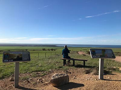
The trail followed road between farmland and we were convinced a small wombat family lived up top with dens and burrows dotted along the fence line. We also came across a gangster team of alpacas who were ready to rumble if it wasn’t for the fence between us. The wind was blowing directly from the north behind us and the clouds started rolling in and darkening. We could see Pt Clinton in the distance and as we turned west to walk down the hill, our feet felt the hard surface of the road along with our unseasoned hips carrying packs. We would call it a night at Pt Clinton after nearly 19km.
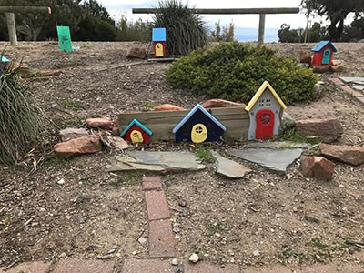
We crossed the highway once more, passed a cute little fairy garden before finding the Pt Clinton Caravan Park right by the beach. We pitched the tent with a bit more confidence after the trouble shooting the night before just as the drops of rain started. The wind shifted to the west and we hunkered down with a building sheltering some of the wind. I ducked to the General Store to grab something to chuck on the stove as we discovered we might be one meal down for the 6 nights until resupply. I’m embarrassed to say baked beans and spaghetti was on the menu with fresh cakes from the General Store and potato chips to replenish our salts. We sat on our (now shared) camping mattress eating ourselves silly as we listened to the rain pick and puck on the tent roof.
Day 3 SALTY WOMBATS
Port Clinton to Ardrossan 29km (8 hours)
It was a rough night’s sleep with air conditioner motors some 10 metres from our heads in the cabin next door kicking in every 3 minutes for the whole night plus the lights that didn’t go out at the toilet block 5 metres from our tent. But that was the trade off for a sheltered spot as it was a long night with gusts of wind and rain that kept us on edge with how the new tent would hold up (it did). It was a relief to get up and get going, albeit in dark moods thanks to a sleepless night and knowing we had a huge day ahead (and a storm to beat) to Ardrossan.
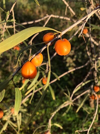
At least the first 7km section of walking to Price was gorgeous. We walked along the coastline looking over the mangroves and swampy area with trees and plants each side of us. The native apricot was flowering and moss covered the shady patches of scrub. We headed down Story Steps where wombats are known to live. Plenty of burrows and poo but the wombats had gone to bed for the day.
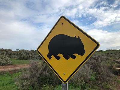
Price was an interesting little spot too with history around salt mining and harvesting. Little did we realise this location produces the most salt in the southern hemisphere supplying Australia, NZ and Asia. How’s that for little old Price!
We tried to stop for a peaceful break and of course a truck rolled in and idled right next to the bench and public toilets for our entire break. Our quest for country zen continued…..
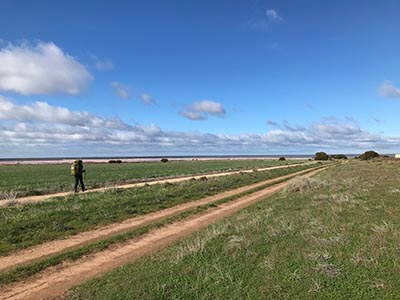
So we headed off towards Tiddy Widdy sighting a roo as we walked the trail that paralleled the salt mining operations. It got soo muddy when we headed towards the coast as we slid our way to our lunch spot. We thought we would have lunch at Macs shelter but the winds picked up again from the north west and it made it almost too tricky to boil water for lunch for our cupasoups but we created a wind break and with determination we enjoyed wraps, tuna and a hot soup each.
Once we left the shelter we started on sandy dune country with monarch butterflies, the odd sea shell and wattle trees. It even got warm. Later we read about this area being burial grounds for Narungga people but sadly it was also a dumping ground for furniture and all kinds of hard rubbish.
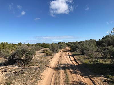
We knew the weather was coming in rough again and after a long road walk where you could see the end oh so far away, the psychological battle began. Eventually we made it to Tiddy Widdy Beach learning about the wells that Narungga people once used. We checked the time and realised it was a bit later than we thought – we were slowing down and needed a break. This gave us a chance to check the weather and a severe thunderstorm warning with large hailstones had been issued. The dark clouds on the horizon were starting to rumble and rolled in quickly as we left Tiddy Widdy.
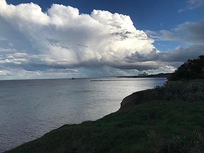
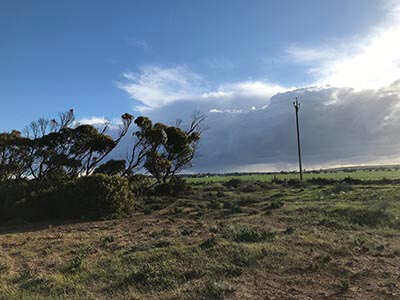
With a few km to go we legged it to Ardrossan. Somehow after 25km we had power in the legs to speed up and try and beat the storm. We arrived in a sweaty heap to the Ardrossan Caravan Park with a cabin prebooked. As we made our way to the cabin across the creek and on the other side of the park, the heavens opened with heavy rain. We took shelter under a shed and with a crack of lightning and instant gunshot thunder, we both dropped to the ground convinced we had almost been hit. It was terrifying.
We waited for the rain to stop and made our way to the cabin, sufficiently stuffed and ready for a big feed. The take-away shop was conveniently located across the road – an early dinner was in order. Plus icecreams. The supermarket was also open so we stocked up on some fresh fruit for the next day and some chocolate bars as a treat.
Day 4 WHALES AND WELLS
Ardrossan to Pine Point 21km (6 hours)
This was probably our best nights rest so far – a proper bed and showers. Nice. We got up super early to get another big day in – if we thought the last 2 days of weather change was bad, well the worst was yet to come.
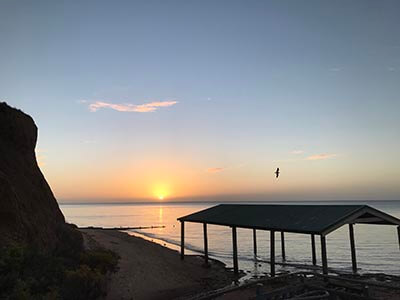
We headed back down to the jetty for some sunrise beauty before heading along the cliffs for an educational walk learning about Windara Reef, ochre Dreaming stories and later the 7 sperm whales that beached themselves in 2014. We then found ourselves back on the coast past the moving memorial for the whales and through the bush camping at Parara before reaching James Well and Rogues Point. Both holiday house meccas with a few locals too.
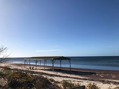
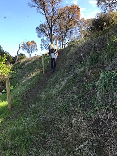
Then it was cliff top walking next to farmland. We were “fertilised” by a local farmer thanks to the strong north westerly wind that covered us in white pellets. We navigated gullies and steep drops in places to get through the trail that was incomplete and not marked. We also passed through another section of wombat country before reaching Rex shelter. For the third day in a row, the shelter was just too windy for us to do lunch and so we had a little break to eat snacks and with the sky changing colour rapidly yet again, we decided to make for Pine Point instead of our intended destination Black Point.
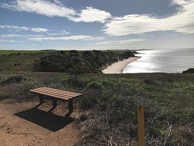
The radar had a fast moving rainbow approaching and we really didn’t want to get caught in that. We also considered booking into accommodation as the storm brewing might not have been good for tents. The thunder started to rumble as we reached Pine Point. The Caravan Park and Kiosk had an on site caravan available offering us better shelter than the tent for a lean $60. We gratefully took the key after stocking up on naughties to enjoy once the storm hit.
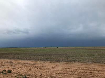
We used the afternoon to catch up on news, journaling, eating and rest. Outside the wind howled, the rain bucketed with thunder, lightning and later, hail too. It was sooo nice to be rugged up in a van!
Day 5 STORM
Pine Point to Black Point 5km (90 mins)
We woke to a horrendous noise around 5am – the hail and thunder was deafening on the caravan roof and we were actually too scared to look at the forecast, we knew it was going to be bad. The forecast was severe weather again and we knew it would probably be the worst day to walk or even try. We had 29km to cover. It was a tough day to get motivated about when the rain just wouldn’t stop and the sky was black. Just as we left Pine Point we took a photo of a sign mentioning Tim’s Taxi Service. Didn’t realise there was a taxi service on the Peninsula. Handy.
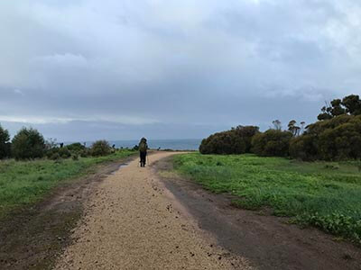
We headed off in sideways rain that stopped momentarily for a few minutes allowing me to take photos and second guess what we were aiming to do. The rain had seeped through my wet weather pants and boots and I was freezing cold. We had only been walking for half an hour. We made it to Black Point some 4-5km from Pine Point and sheltered at the caravan and camping ground. The wind gusted and sideways rain continued to bucket down. I couldn’t get warm. We were also under pressure to beat the tide as we had a beach section to complete before Pt Julia. Every minute we waited under the shelter meant we could get stuck on the beach between water and cliffs (with no way out).
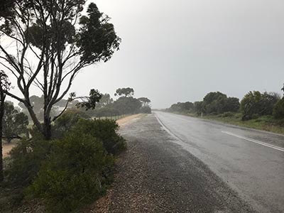
At this point and after some discussion around stupidity and being on the news, we decided to call a cab to Pt Vincent. We took turns going into the amenities block to get under the hand dryer to warm up while waiting for the cab. The friendly Guy came and picked us up and drove us to Pt Vincent. He was lovely and dropped us off at Chill Out café where we could warm up as it was a bit early for us to check in to our pod at the Pt Vincent Foreshore Caravan Park. In the short time we were in Pt Vincent, we had been offered a lift by a complete stranger who was interested to know more about our walk and then locals in the café struck up conversation about our quest. Good old country hospitality. We sat in the café sipping hot drinks and devouring cakes as the spoggies visited for tidbits. We had seen little birds along our wet walk to Black Point hiding in the trees and coming out between showers.
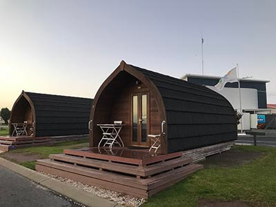
Lucky for us our pod was ready and we were allowed to check in early and commence operation dry out. We rested in the afternoon, splurged with hot cinnamon donuts from the local kiosk and cooked a very average pasta meal by torchlight.
Day 6 SHEOAK AND OCHRE = SHEOCHRE
Port Julia to Stansbury 33km (10 hours)
With Guy booked to pick us up at 7.15am our day started early. We couldn’t complete the beach section to Pt Julia due to the tides and this would make a 40km day of walking to Stansbury so we decided to attempt 33km. It started with a brilliant sunrise and a few spots of rain and icy cold wind. We wore our wet weather gear for a wind break and to stay warm.
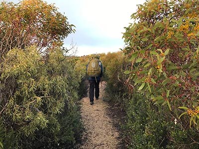
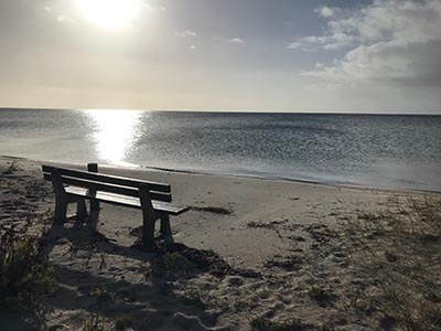
Lots of birds with honeyeaters, willy wagtails, galahs and more flying in to greet us. When we reached Sheoak Flat we saw over 60 hooded plovers (endangered) and pelicans. I had never seen so many hooded plovers in one place! Our morning tea spot here was dreamy. A glassy lake ocean and seat right on the sand. Amazing.
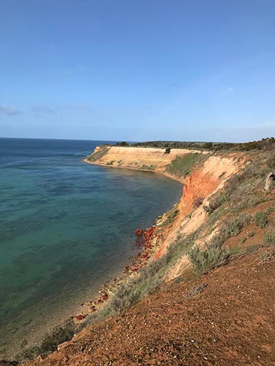
The rainbows came and went all day. We counted no less than 7. We stayed on the cliffs after a bit of road walking and the colours came alive – red rocks, orange cliffs, blue skies and greeny blue water. Even the dolphins came out to say hi.
We made our way to Pt Vincent past the golf course (some of the tee offs were literally hanging off the cliff) and on beautiful bush trails past the fancy marina and along the foreshore, back to where we slept the night before.
We decided we deserved hot chips on the way through (15km down, 18km to go) which I have to say powered us to Stansbury. It was also rare to pass through a town during the day when shops were open so we made the most of it.
We named this section SHE OCHRE as there were loads of sheoak trees and ochre cliffs where Narungga people shared Dreaming stories of how the cliffs became red.
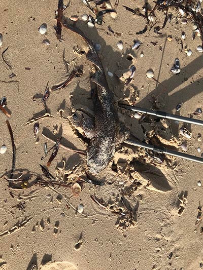
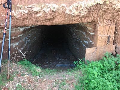
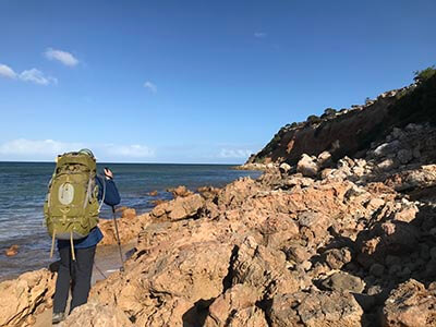
The afternoon seemed like a different world and this may have had something to do with our level of fatigue – we saw a house on a tower in the middle of nowhere, lime kilns and we hit a beach section at exactly low tide without actually researching to make sure we would be OK to do this section. This was a rock hopping section but also had an old chalk mine, shells, rocks and even a baby shark that we put back in the water as it was still alive.
After the beach though it was all road walking to Stansbury and really it was attitude that got us through (and possibly those hot chips at lunch) as it was a bit of a slog after a long day of walking. It was just getting dark as we grabbed a cabin key from the Stansbury Caravan Park and checked in. Sore shoulders featured heavily tonight and we were glad to cook a quick dinner, shower and hit the hay.
Day 7 LIMESTONE
Stansbury to Coobowie 24km (7 hours)
We definitely woke feeling flat after such a huge day yesterday. We were slow to start and faffed a lot longer than usual with our gear and getting packed. The walk out was along a trail with great bird signs which was really interesting and the brightest coloured pigface we had seen. The waves rolled in with a soothing sound as we left Stansbury.
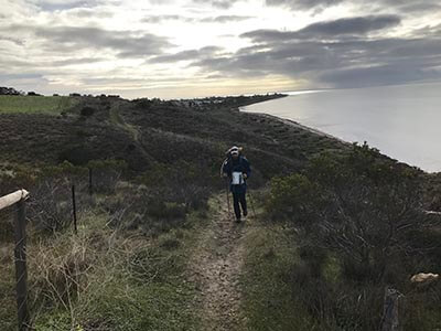
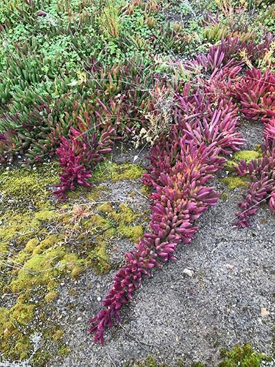
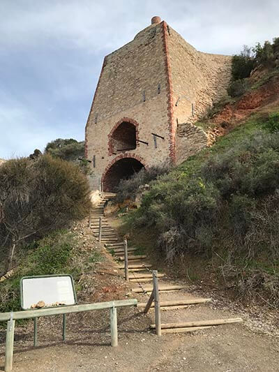
Psychologically it was frustrating to leave the coastline to avoid another mine – this time limestone – the road walking was painfully hard on the feet and we were so glad to reach the water at Wool Bay. We had a lunch here in the stillness on the cliff top overlooking the glassy ocean. There was also a big lime kiln in the cliff that was over 100 years old. Other exciting sightings on our walk were seeing a dead colourful centipede and 2 sleepy lizards.
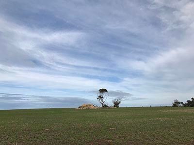
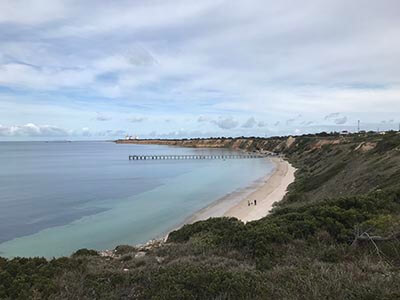
The walk towards Pt Giles was a mixture of road towards giant silos and the jetty and a back trails past old dumpsites. Once past the giant silos we meandered along still coastline, near the water, passing Hickeys shelter where nice potential camp sites were hiding in the shrubs. Like almost every afternoon on the trail so far, the rain arrived like clockwork and we had just enough rain to wet all the gear before we reached Coobowie. We arrived to our humble abode (a holiday house) for the next 2 nights very ready for a rest day and a reunion with Gulliver and the inlaws. Feeling slightly hangry we headed for the nearest take away shop where massive amounts of soft drink, deep fry and salt replenished some weary bodies.
Our first 7 days was complete with 140km or so done and 340km or so to go. After leaving Coobowie we knew we would be entering a section far more remote and less serviced compared to the journey along the eastern side of the Peninsula. We refilled our food bags, dumped a few items not in use, added an air mattress for Ian and set off with full packs once more for the next dramatic chapter for our Walk the Yorke Adventure…….
So did we feel recharged?
Did nature provide the much needed therapy we hoped to experience while walking?
YES.
After 5 days, our minds slowed and we stopped checking our phones in favour of flight mode – we avoided screens (and news about the virus that shall not be named) and this did wonders to how we felt. We also slept longer and deeper as the walk progressed. All that fresh air does nothing but good things for our bodies, minds and souls.
We were just starting to feel “pack fit” as we approached our rest day and ready for a bit of laundry too despite our iOmerino gear performing brilliantly over the first 7 days.
There is just one section we missed thanks to the mega storm (Black Point to Port Julia) so we do have unfinished business still.
Was it the best walk we have ever done? Probably not the most scenic with so much road walking but again this is an endurance experience and the long distances provided time and space to reflect even be creative. Plus we LEARNED SO MUCH about Narungga history, events and places that we had previously driven past with no knowledge of what had taken place on the land. Plus the Dreaming stories connected us to ancient practices and culture – this alone had enriched our journey.
And we knew the most remote beachy sections were yet to come….
Additional Reading
Big Heart Adventures is a commercial tour operator (CTO). Registered to lead walking adventures along the Walk The Yorke and throughout Australia and overseas. We offer fully guided walking tours and self guided walking adventures.
You can see our Yorke Peninsula walks here
Read more about ‘Big Heart Adventures’ and our wellness walks
Get information on our women’s walking group ‘Wise Women Walking’
We look forward to sharing a Big Heart Adventures South Australian Walking Experience with you!

